City Through Time 3D
A city's real buildings rise in 3D era by era at the heights of their time, and the events that changed it play as the narrator names them.
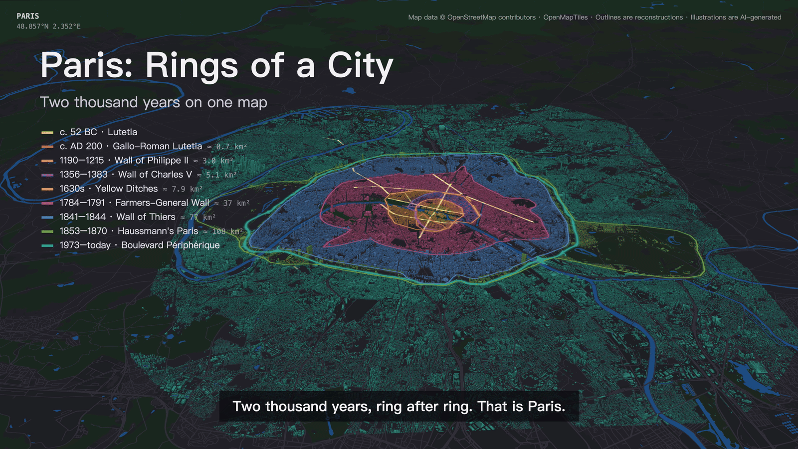
A narrated 3D map film of how a living city grew and changed. The globe turns to the city and the camera dives onto its real buildings; era by era, today's buildings inside that era's walls rise in 3D at the heights of the period, on top of the earlier city, while events that changed the city play as the narrator names them: a fortress rising and coming down, new boulevards cut through, a river flooding the streets. It ends on every era's ring at once.
How it works
Resolve: outlines, today's buildings with their heights and the lines events name, from OpenStreetMap
Media: narration and illustrations through SandBase, after a cost estimate
Render in Chrome with MapLibre GL, frame by frame in parallel workers, with the narration laid in
Frequently asked questions
How is this different from City Through Time?
Same story.json and the same idea; the 2D version lights the streets of each era on a flat map and renders anywhere in 15-20 minutes. The 3D version raises the real buildings at each period's heights and plays city-changing events, and needs Chrome with WebGL.
Why are old buildings low?
Buildings are today's footprints with their mapped heights, capped to what each period built: about 9 m before 1500, 22 m in the 19th century, real heights only in the modern eras. The street plan of old eras is not reconstructed.
Which events get effects?
Only events that changed the city, at the moment the narrator names them: a landmark rising or falling, new boulevards or rail cut through, a flood. There are no decorative effects.