City Map Poster
Turn your city into minimalist posters from real map data: the street map, a skyline from mapped building heights, a food map of every mapped café and restaurant, and landmark outlines, in five themes with a print-size PNG.
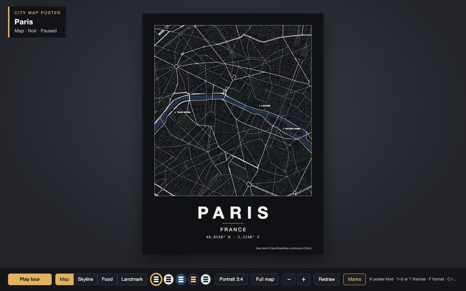
Bring a centre, a radius, up to five places to mark and up to four landmark buildings. The Skill returns a downloadable Skill (map bake, meta prompt, lessons, verification), four kinds of runnable poster, print PNG export and a 60-second film.
How it works
Bake from OpenStreetMap: streets, water and parks, building heights and food places in tiles, and each landmark’s outline.
Write the city’s name in style.json, adjust the themes if you like, then check every kind, theme and format.
Verify headlessly, build one self-contained HTML file, record the film and export print PNGs.
Frequently asked questions
Does it call any model or need a key?
No. The Skill gives your agent a prompt, lessons and a reference scene; the scene itself makes no network calls.
Why is the demo sandboxed?
The frame has an opaque origin and no network access, so the scene can’t read anything from this page or reach the internet.
Is it a traced or generated picture?
No. Lines, outlines, heights and places are mapped features in their real places; colours, widths and type come from the theme.
Why does the food map look thin in some cities?
It shows what OpenStreetMap has. Coverage differs a lot between cities, and the poster prints the counts it found.
Can I print it?
Yes. scripts/poster.mjs renders the same poster at print width, for example 3600 px wide, which is 30 cm at 300 dpi.
What about the map data licence?
Map data © OpenStreetMap contributors under the ODbL. The credits line is drawn on every poster and export; keep it when you print or post one.
Why is there no online generation?
Building a new scene needs a model key inside the sandbox, which the backend doesn’t support yet. Run the Skill with your own agent for now.